Tag: Lower Lea

“Green light for green corridor from Olympic Park to Thames”

Here is an important news story about the future of the Lower Lea Valley:

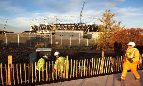
” THE final jigsaw piece in post war city planners’ ambitions to link London’s green belt with the Thames will be realised in time for the 2012 Olympics, nearly 70 years after its initial inception.

The London Thames Gateway Development Corporation has given the green light to build the backbone for a new urban park in east London, linking the Olympic Park at Stratford with the Thames at the East India Dock Basin.”

Read the whole story at the East London Advertiser

Having walked around both sides of the mouth of the Lea and along the whole length of the Lea from the Limehouse Cut to Waltham Abbey, I’m pretty happy to see planning approval for the final link of pathways along this stretch of Bow Creek.  I hope they find a way to maintain and highlight some of the industrial heritage alongside river.  I’m a big fan of the wetlands created out of the East India Dock basin and I hope this kind of hybrid of renationalisation and industrial heritage can work in other spaces along this new corridor of parkland.

Remaking the Bow Back Rivers: environmental and social intervention to decrease flooding and unemployment in West Ham, 1905-1935

The recent past
The future

Promotional literature for the 2012 Olympic games promises to transform the environmental and social conditions in the Lower Lea Valley: “The natural river system of the valley will be restored, canals would be dredged and waterways widened… The rehabilitation of the Lower Lea Valley lies at the heart of the Olympic legacy to east London, restoring an eco-system and revitalising an entire community.”[1] This, however, is not the first time the Bow Back Rivers have been the focus of a major public works project with the goals of improving social and environmental conditions in West Ham.  Half a century of rapid industrial and suburban growth left the tidal Back Rivers of the Lower Lea in rough condition by the end of the nineteenth century.  The polluted and silted streams decreased the rivers utility for transportation, threatened public health, and increased the threat of flooding.

Olympic site begins to take shape, but the Lea remains polluted


http://www.guardian.co.uk/uk/2009/oct/30/stratford-london-2012-olympics

The Guardian published another article on the Olympic transformation taking place in West Ham.  Anna Kessel is impressed by the changes in the landscape and she looks forward to the time when the Lea is transformed into a more pleasant river.  Interestingly enough, she is not the first person to bemoan the condition of the Lower Lea and its back rivers that flow through the 2012 Olympic site.  In 1844, decades before the height of the industrial boom in West Ham, James Thorne, in his book Rambles by Rivers, talks about the Lower Lea and its degraded industrial condition:

But by this time our river has ceased to be either picturesque or interesting: lime-kilns, calico-printing, and distilleries are the most prominent objects along its banks; and however useful these may be, they are not agreeable to either nose or eye.

Early Industrial Development on the Lower River Lea

The development of railways [1839] and docks [1855] in the parish of West Ham corresponded with significant industrial development in the mix of wetlands and rural landscapes on London’s suburban fringe in the mid-nineteenth century.  That being said, the Lower Lea and the parish of West Ham had some industrial development centuries earlier.  Along side the early industry, human transformation of the physical landscape began with marsh reclamation for agriculture, which also started centuries before the suburban and industrial boom in the second half of the nineteenth century.  To fully understand the landscape transformation of the nineteenth century we need to better understand the long history of human labour that transformed the wetlands of the Lower Lea through to the early nineteenth century.

To accomplish this goal, I’ve been doing some work to map the early industrial transformation on the Lea, before the heavy industry began to arrive in the mid-19th century.   I found that the Lower Lea was a site of industry at the time of the Norman Invasion of England and the Domesday Book.  Millers on the Lower Lea used the tides to grind grain and other products.  These mills remained in place during the early nineteenth century and at least the Three Mills remained operational through to the twentieth century.  This long continuity of industry in the parish of West Ham foreshadowed the massive industrial growth in the second half of the nineteenth century.  New industries, such as Calico Printing in the eighteenth and early nineteenth centuries and then the chemical and animal rendering industries of the nineteenth centuries started near the old mill sites, before spreading along the banks of the Stratford Back Rivers.  The GIS map below provides a conservative estimate of the industrial footprint near Stratford High Street in 1810 .

Stratford Back Rivers Industry 1810